An architect’s guide to the only sub-district that holds both a working mountain interior and a stretch of the southern coast.
Namuang is the most varied of Samui’s seven sub-districts, and the least understood. Most people who know the name associate it with the waterfalls and the inland mountain country, and that is half right. Tambon Na Mueang covers a long band that runs from the southern coastal strip near Hua Thanon, westward along the south coast through Bang Kao, Laem Set, and Thong Krut, then inland and upward into the mountain interior with the durian farms, the reservoir that supplies most of the island’s drinking water, and the two waterfalls that give the area its name. It is the only sub-district that contains both a working agricultural and forested heartland AND a meaningful stretch of coastline, and this gives it an unusually wide range of land types and design briefs.
For an architect’s client, Namuang is the answer to two quite different questions depending on which part of the sub-district you are looking at. On the southern coastal strip, it is a quieter, more authentic alternative to Lamai or Choeng Mon, with small fishing villages, brightly painted longtail boats, and seafront plots that still come at sensible prices. Inland, in the elevated mountain country, it is where eco-lodge briefs, off-grid retreats, and small wellness developments make the most natural sense on the island. Both parts of Namuang are genuinely undervalued by buyers who think only in terms of the better-known coastal areas, and both reward thoughtful design.
Important update before going further
A new environmental protection law for Surat Thani Province came into force on 21 May 2025, applying to Koh Samui, Koh Phangan, Koh Tao, and surrounding islands. It introduces seven new environmental protection zones with significant new restrictions on hillside development.
The points worth knowing for Namuang specifically:
- In the new hillside zones, only one single-family home is permitted per parcel, capped at 6 metres in height with 50% required green space
- Retaining walls and resort-style developments are no longer permitted in the affected hillside zones
- Land subdivision is prohibited in those zones
- On any sloped land at 35% gradient or above, special permission is required to grade or alter the terrain or remove large trees
- Developments with 10 or more rooms now require grease traps, formal wastewater treatment, and proper drainage as a baseline
The new framework applies in full to most of the elevated interior of Namuang, which is where the new rules have the most material impact. The southern coastal strip is largely below the relevant altitude thresholds and is governed primarily by the standard distance-from-beach rules rather than the new hillside framework. Any project on elevated land in the area now needs careful zoning verification against the May 2025 maps before purchase.
The shape of the land
Namuang has more variety than any other sub-district. It is best understood in three parts.
The southern coastal strip runs roughly from the Hua Thanon boundary in the east, westward through Bang Kao, Laem Set, and Thong Krut. This is a quiet stretch of low-lying land, mostly flat, with small fishing villages, beachfront seafood restaurants, and the boat departure points for trips out to Koh Tan and Koh Madsum. The beaches here are not generally good for swimming (the water is shallow and the seabed has coral, sand, and rock in patches) but they are genuinely scenic, with the offshore islands sitting in front of you on the horizon. The mood is rural, slow, and authentic in a way that the busier east-coast beaches no longer are.
The middle band, set back from the south coast and rising gently into the foothills, is where the durian and rambutan farms have traditionally dominated and where some of the more interesting recent eco-development has begun to cluster. This is workable land for low-density residential or small commercial briefs, with sea views to the south on the higher plots and the mountain rising behind. Land prices here are still reasonable by Samui standards.
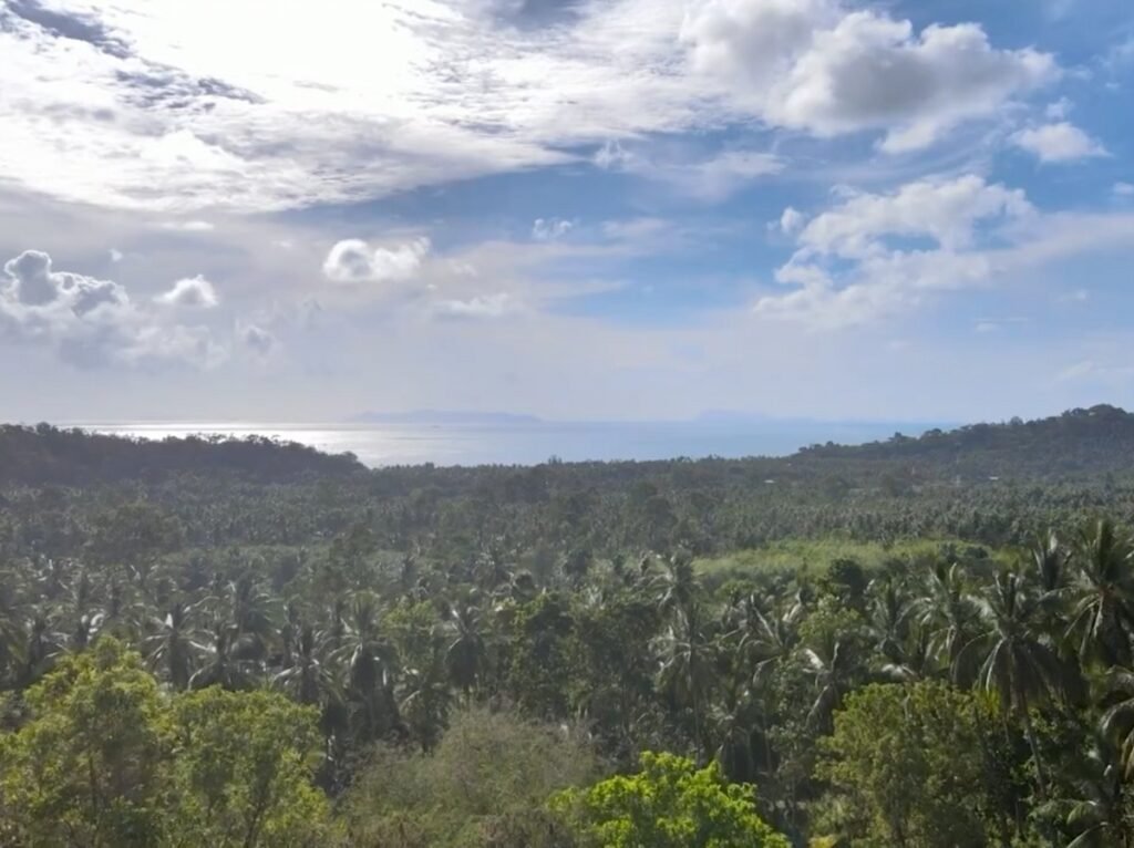
The inland mountain country is the heart of the area, climbing into the central highlands of Khao Pom mountain. The reservoir that supplies a significant portion of the island’s mains water sits on a plateau in this band, fed by the streams that come down from the higher slopes. The two Na Muang waterfalls are the area’s signature natural features. Na Muang 1 drops 18 metres into a wide natural pool a short walk from the road, and is one of the more visited natural attractions on the island. Na Muang 2, set further into the jungle and reached by a short trek, is a more dramatic 80-metre cascade that feels genuinely remote even on a busy day. The rocks beneath both falls have a purple-grey hue from the mineral content of the local granite, which is what gives the falls their Thai name (Na Muang translates roughly as “purple water”). The forest cover up here is substantial, the air is noticeably cooler than the coast, and the buildable plots tend to be tucked into clearings between the durian groves and the rainforest.
What good Namuang design responds to
Because Namuang covers two distinct types of land, the architectural conversation has two distinct registers.
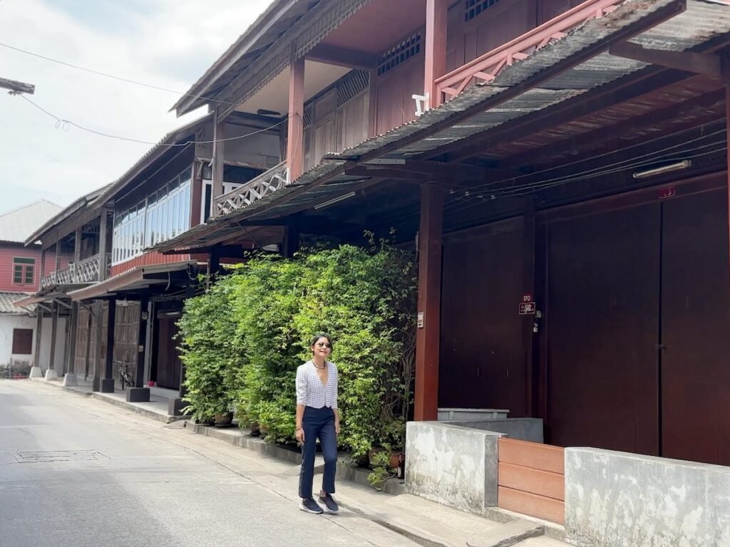
On the southern coastal strip, design needs to respect the slow rhythm of the village context. The small fishing communities at Hua Thanon, Bang Kao, and Thong Krut have settled architectural cultures of their own, with traditional wooden houses, simple seafood restaurants, and a pace of life that has held on against the development pressure that has reshaped the east and north coasts. Buildings here that try to import a generic luxury-villa aesthetic tend to read poorly. The better contemporary work in this strip uses traditional Thai roof forms, generous overhangs, raised floor plates, timber and local stone, and a willingness to sit within the village rather than dominate it. Plots tend to be modest in size, and the architectural opportunity is to do quietly considered work rather than statement architecture.
The south coast faces south, which is unusual on Samui (most of the island faces east, west, or north). The sun arc passes overhead through the middle of the day, with the morning sun rising over the offshore islands to the east and the afternoon sun setting toward the west. This is generally a forgiving orientation, with neither the brutal afternoon glare of the west coast nor the demanding sunrise problem of the east coast. Outdoor terraces and pools can be sited with reasonable freedom. The coastal strip is exposed to the northeast monsoon during the November to January wet season, with the bulk of the rain arriving from that direction.
In the inland mountain country, the design conversation shifts entirely. The climate is meaningfully cooler. At 100 to 200 metres above sea level, daytime temperatures often run two or three degrees lower than the coast, and night-time temperatures can drop noticeably further. The cooling effect of the surrounding forest is genuine. This changes the brief: a Namuang inland house can use significantly less air conditioning than a coastal one, and well-designed natural ventilation can carry most of the cooling load through much of the year. Wind exposure is generally lower than on the coast because the surrounding terrain breaks the prevailing monsoon flows. This makes outdoor living spaces more usable through more of the year.
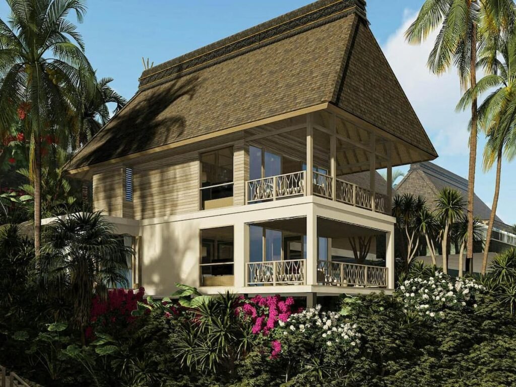
The eco-architecture brief is genuinely viable here as both a private residential proposition and a small commercial one. The architectural language that suits the inland context is recognisable: timber and rammed earth or local stone, deep overhangs, generous covered outdoor space, lifted floor plates that allow air to move underneath, properly engineered natural ventilation, solar PV with battery storage rather than grid dependence, rainwater harvesting integrated into the roof design, and grey-water and black-water treatment built into the landscape design. None of this is exotic. All of it performs particularly well in this climate, and most of it is more cost-effective on a 30-year horizon than the standard coastal villa specification.
The eco-lodge and small wellness retreat brief has been gaining real traction in this part of the island over the past few years. The interior is quiet enough for the stillness that retreat clients pay for, distant enough from the coast to feel like an escape, but only fifteen to twenty minutes from Lamai or the south coast if guests want a beach day. The May 2025 wastewater rules for developments with ten or more rooms now require formal wastewater treatment as a baseline, which actually aligns well with the kind of design ethos that makes sense in this area.
The reservoir and the catchment zone
The reservoir at the heart of the inland Namuang area is more than a scenic feature. It supplies a significant portion of the island’s mains water, and its catchment area is protected under environmental controls that pre-date the May 2025 law. Plots within the catchment zone face additional restrictions on what can be built and how wastewater can be handled, and these restrictions are taken seriously by the relevant authorities.
For any plot in the inland part of the area, identifying whether you sit inside or outside the catchment zone is one of the first practical questions to answer, because it materially affects what you can build. A surveyor and an environmental consultant who knows the local rules are both worth their fees on any plot in this zone.
Drainage is the other technical area where inland Namuang design is more demanding than coastal building. Surface water management on sloped land is non-negotiable during the heavy rains of October and November, soakaways and septic systems need to be designed to higher standards than on the coast, and any plot adjacent to a stream or seasonal watercourse (which is most of them) needs careful water-management design at the early stages of any feasibility brief.
Lifestyle, infrastructure, and access
Infrastructure in Namuang reflects the rural character of the area. On the southern coastal strip, mains water and three-phase electricity reach most plots near sealed roads, and fibre internet has rolled out to the village centres with patchier coverage in between. Inland, the picture is more variable: mains water reaches main roads but rarely far beyond, three-phase electricity may need to be brought in on new poles for remote plots, and several recent eco-lodge developments have gone fully off-grid with solar and battery rather than connect at all. Fibre internet is good in some pockets and patchy in others.
The road network is the area’s most practical asset. The cross-island Route 4172 connects Namuang’s southern coastal strip to Hua Thanon and Lamai in the east and through to the inland mountain area, with secondary roads leading to the waterfalls and the various villages. Inland tracks can be steep and rough in places, particularly during the wet season, and four-wheel-drive is genuinely useful rather than affected on some plots. The Ring Road (Route 4169) connects the south coast east to Lamai (10 minutes), Chaweng (25 minutes), and the airport (35 minutes), and west to Taling Ngam, Lipa Noi, and Nathon.
The community profile on the southern coastal strip is mixed: settled Thai-Muslim fishing families in the older village core at Hua Thanon, Thai families across the wider south coast, and a small but growing layer of long-stay expats and second-home owners drawn by the quiet authentic character. Inland, the community is more rural still: durian and rambutan farmers, a small but visible eco-tourism workforce, a handful of activity providers around the waterfalls and the elephant sanctuaries, and the various staff associated with the Samui Stadium and the inland public facilities. The vibe across Namuang as a whole is the most genuinely rural anywhere on Samui, and it is the area’s strongest selling point for the right buyer.
The distance to amenities is the obvious trade-off. Lamai is around fifteen minutes by road from most points in Namuang, Lipa Noi twenty minutes, Nathon twenty-five, the airport thirty-five to forty. For a short-stay tourism rental this is too far to make economic sense. For a primary residence or a long-stay second home, it rarely matters because the brief itself is about being away from those places.
A practical sequence for a Namuang plot
The standard sequence applies. Confirm the Chanote, check boundaries against the ground, verify zoning under both the older planning maps and the May 2025 environmental zones, check altitude and slope on any inland plot, confirm distance from the high-tide line for anything coastal, and verify whether the plot sits within the reservoir catchment zone before committing.
The Namuang-specific things to watch for are catchment-zone restrictions on inland plots (the protected area extends further than people sometimes assume), access road status (some inland tracks have unclear legal status as roads, and resolving this after purchase can be expensive), tree cover on sloped land (the May 2025 rules now require permission for major tree removal on slopes above 35 degrees), and utility connection feasibility (the cost of bringing three-phase electricity or mains water to a remote inland plot can be substantial enough to change the project economics).
A licensed surveyor is essential on any sloped or elevated plot. An environmental consultant who knows the catchment rules is worth the fee on any plot near the reservoir. A Thai property lawyer who has handled rural land transfers is the right person to verify access rights before you commit.
Final note
Namuang is for the buyer who is genuinely looking for something different. On the southern coastal strip, it is a quiet authentic alternative to the busier east-coast beaches, with small village character that has held on while the rest of the island has changed. Inland, it is the part of Samui where eco-lodges, wellness retreats, off-grid family compounds, and primary residences that genuinely want to live within the natural environment all make the most sense. The land across both parts is more affordable than the equivalent coastal areas, the constraints are real but the architectural opportunities are some of the most interesting on the island.
It is also the part of Samui where thoughtful design makes the biggest visible difference, because there is less here that has been spoiled by careless building, and a project handled well can sit comfortably within the landscape for generations.
Considering land in Namuang, Bang Por, Bophut, Maenam, Choeng Mon, Bangrak, Chaweng, Lamai, Taling Ngam, Lipa Noi, or Nathon? Get in touch for a preliminary land viability assessment. Don’t forget to check out our Youtube Channel and our Knowledge Hub for more invaluable insights.
See also:
- Koh Samui: an architect’s introduction for prospective buyers
- Four ways to acquire a home on Koh Samui
- Taling Ngam: building on the Virgin Coast
- Lamai: building on the east coast’s working alternative
- Lipa Noi: building on Samui’s quiet southwest
Note on regulations: zoning, height, altitude, slope, and environmental protection rules are subject to change and to local enforcement variations. The 21 May 2025 Surat Thani environmental law in particular has introduced new restrictions that may not yet be reflected in older online guides. Always verify current rules with the Land Office and a licensed Samui architect or legal advisor before relying on this guide for any acquisition or build decision.