An architect’s guide to land viability, zoning, and what the west coast asks of a design.
Nathon is the quietest “main town” you will find on a tourist island. It is the administrative and commercial heart of Koh Samui, the seat of the Tesaban municipal office, the location of the main vehicle ferry terminal to the mainland, and home to a settled local population of around thirteen thousand people. It is also one of the few places on the island that still feels like the Samui that existed before the airport was built in 1989.
For someone considering building here, whether a private home, a small commercial property, or a low-density residential project, Nathon presents an unusual combination of opportunities and constraints. The land is more affordable than the popular east coast. The infrastructure is genuinely good. But the topography, the protected hillside behind the town, the proximity-to-beach rules, and the west-facing orientation all shape what is buildable, and how.
This guide is written from an architect’s perspective. It assumes you are at the stage of asking whether Nathon is right for your project, and what a feasible building on land here might look like.
An important update for Nathon landowners
A province-wide environmental protection law came into force on 21 May 2025, adding new hillside-development restrictions across Koh Samui, Koh Phangan and Koh Tao — see our island overview for the full rules. For Nathon specifically, the new framework bans land subdivision in the hillside zones and requires special permission to grade or clear any slope of 35% or more.
Most of Nathon town sits on the flat coastal strip and is unaffected by the new hillside-specific rules. The protected ridge behind the town is largely Forest Department land and was already substantially constrained before this update. Plots on any rising land between the coastal strip and the ridge now sit inside the new framework and need careful zoning verification before purchase.
The land, what is actually there
Nathon sits on the west coast, between Laem Yai to the north and Lipa Noi to the south. The town has a structure that reflects how it grew: a flat coastal plain about half a kilometre deep, held in by a steep wooded ridge that runs almost parallel to the shoreline. Almost everything that was ever built in Nathon was built on the flat strip, because the ridge behind it is too steep, too wooded, and too protected to develop without difficulty.
This matters for site selection more than it might first appear. The flat coastal land is fully built out in the town centre and tightly held: most plots transact privately, often within local families, and rentals dominate over freehold sales. As you move north toward Bang Por or south toward Lipa Noi, the flat strip widens slightly and more land becomes available. As you move inland toward the ridge, you enter a category of land that Koh Samui’s planning system treats with much greater caution.
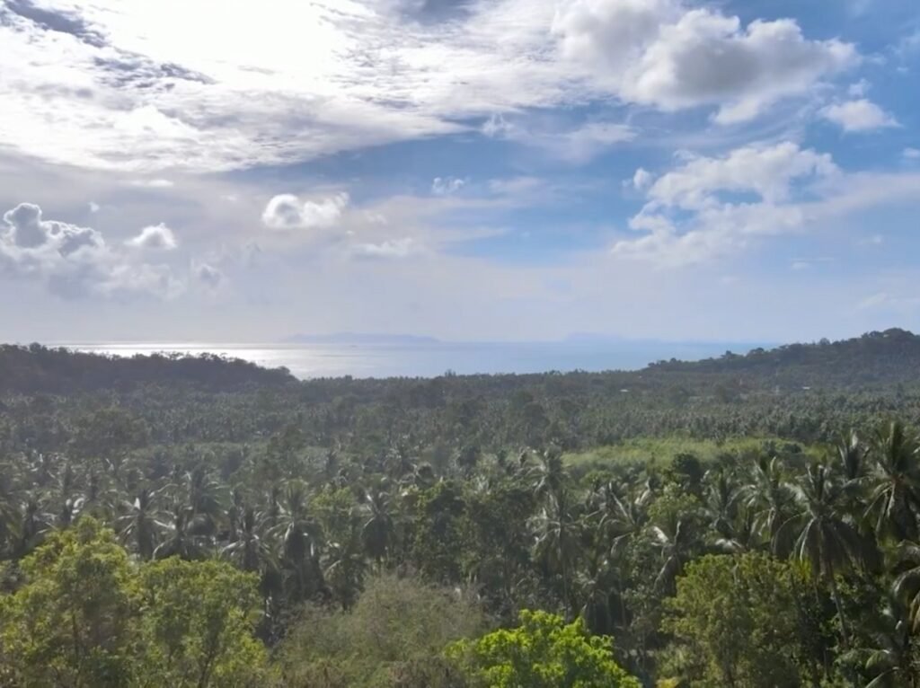
The shoreline itself is unusual for Samui. The beach at Nathon is not what most buyers think of when they imagine a Samui beach. It is narrower, the sand is coarser, and the tides are dramatic. At low tide the water can recede a hundred metres or more, exposing a wide flat. This is a poor beach for swimming and a complicated one for pool houses or beachfront rental projects. It is, however, exceptional for sunsets, and the views west across the Gulf of Thailand to the mainland are among the best on the island.
Zoning, what the colour-coded map actually means
Koh Samui’s zoning is governed by Thailand’s Building Control Act and Town & City Planning Act, refined by island-specific regulations. Nathon includes most of the categories that show up on the master plan, often within walking distance of one another.
Yellow zones (low-density residential) dominate the area immediately around the town and to the north and south along the coast. These zones permit residences and most tourism uses, with a 40% open space requirement, a 12-metre maximum building height, and a 2,000-square-metre cap on total building area for non-hotel projects. For a private villa, this is the zoning you want.
Orange zones (medium-density residential) appear closer to the town centre. The use mix is similar to yellow but the open-space requirement drops to 20%, and a wider range of small commercial uses is permitted. These plots tend to suit mixed-use buildings, such as a residence with a ground-floor commercial space, or a small guesthouse.
Red and dark green zones signal greater restriction. Red zones are typically commercial-leaning and accept only 15% non-conforming use. Dark green zones, agricultural and conservation, permit only limited residential development and require 60% open space. The ridge behind Nathon falls largely into protected categories administered by the Forest Department, and is effectively unbuildable for most purposes.
Light green and blue zones apply to coastal and aquatic areas, with the most restrictive rules of all. The familiar 10-metre no-build zone from the high-tide line applies; from 10 to 50 metres only single-storey structures up to 6 metres in height and 75 square metres in footprint are permitted; from 50 to 200 metres the height limit rises to 12 metres with a 2,000-square-metre maximum building area.
The practical consequence for Nathon is that the most desirable land, close to the water with sea views and sunset orientation, sits inside the strictest zones, while the more flexible zoning sits behind the town where views are blocked or compromised. This is the central design question for any Nathon project: how do you reconcile what is permitted with what is worth building?
Hillside and altitude, the rule that catches people out
Even within a permissive zoning category, Koh Samui imposes additional restrictions based on altitude and slope. These rules apply to the protected hillside behind Nathon and become decisive on any plot above the flat coastal strip.
Below 80 metres above sea level, the standard zoning rules apply with no extra restrictions for single homes. Between 80 and 140 metres above sea level, only single residences are permitted, with a maximum height of 6 metres including the roof, a minimum land plot of 400 square metres, and 50% of that plot required to remain as green open space. Above 140 metres, the building footprint is capped at 90 square metres with the same height limit.
Slope rules layer on top of altitude rules. Slopes below 35 degrees follow standard zoning. Slopes between 35 and 50 degrees permit only single homes with footprints capped at 80 square metres. Slopes above 50 degrees are no-build zones, and recent enforcement under the “Samui Model” (a coordinated programme involving the Internal Security Operations Command and provincial authorities) has resulted in demolition orders for non-compliant villas in this category, including high-profile cases on the east coast in 2024.
In Nathon, the practical effect is that the elevated land behind the town offers terrible odds for development. The ridge climbs quickly, the slopes are aggressive, and the Forest Department oversight is active. A project that hopes to capture a sea view by building uphill needs careful site analysis before any commitment of capital. Any reputable architect will refuse to begin design work without first confirming altitude, slope, and zoning against current planning maps.
What a good Nathon design responds to
If the regulations define what cannot be built, the climate and orientation define what should be built. Nathon’s west-facing aspect is the dominant design driver.
The afternoon sun on a west-facing site is intense. From around 14:00 onwards, glazed western elevations become greenhouses. A villa designed with floor-to-ceiling windows pointing at the sunset (a common request from buyers who fall in love with the view at golden hour) can become uninhabitable for half the day without serious mitigation. The same applies to swimming pools sited on the western edge of a plot: the water heats, the deck becomes too hot to walk on, and the cooling effect of the pool is lost.
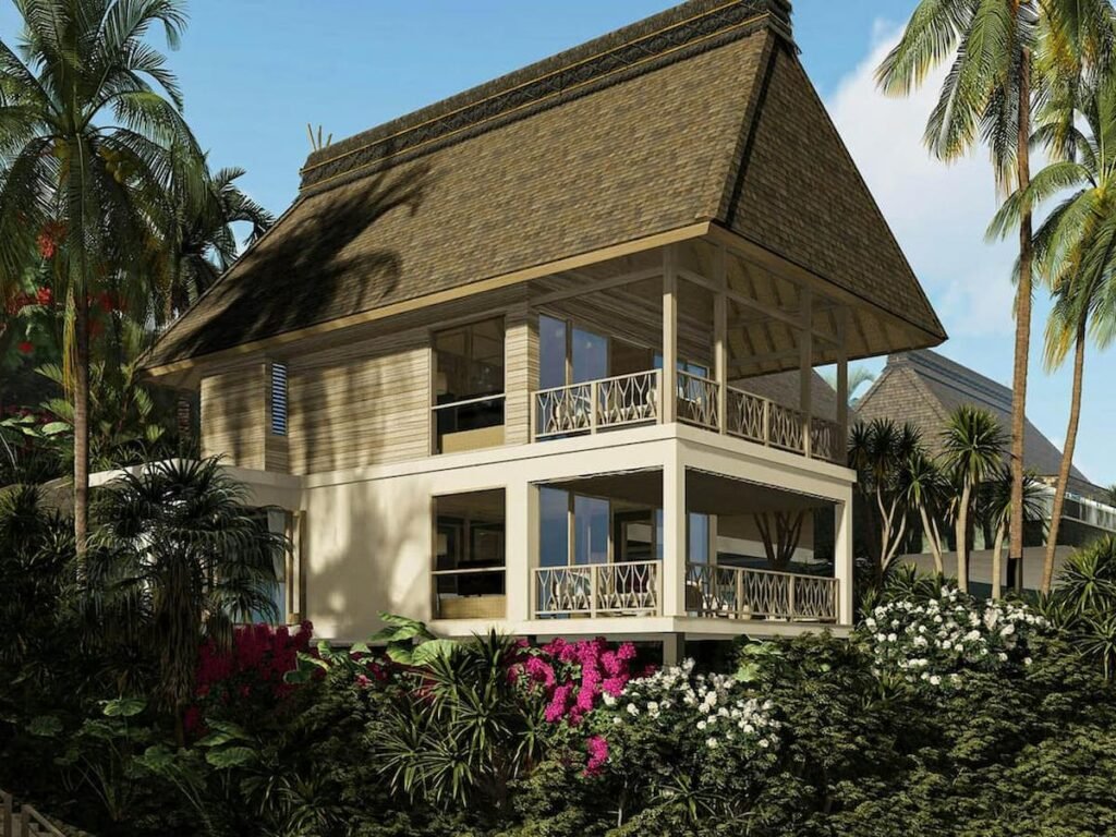
Good west-coast design treats the sunset view as something to be framed, not surrendered to. Deep overhangs, recessed openings, screened verandahs, and operable shading systems (louvres, sliding panels, planted pergolas) are standard tools. Glazing is typically specified as low-emissivity to reduce solar heat gain. Roof forms tend to be deep and pitched, both for compliance with Samui’s prohibition on flat roofs and for the practical effect of throwing shade on the western façade. Cross-ventilation is designed to draw the prevailing south-westerly breeze across the plan and out the leeward side, often through high-level openings that exhaust hot air.
Nathon’s monsoon exposure is a separate consideration. The west coast catches the south-west monsoon from May through October, with the heaviest rainfall typically in October and November. Drainage is critical. Plots near the flat coastal strip have shallow groundwater and can sit waterlogged for days after sustained rain. Plots on the slope behind risk runoff scour if surface water is not properly managed. A site that looks dry in February can be a different proposition in October, and any design that ignores stormwater is a design that will fail.
Foundation design follows from the geology. Coastal Nathon sits on alluvial soils with limited bearing capacity at shallow depth; pile foundations are common for any structure of more than one storey. The ridge transitions to weathered granite with better load-bearing characteristics, but with bedrock that can sit close to the surface and complicate any cut-and-fill operation. The rule for hillside work is that cut-and-fill is limited to two metres maximum, which forces stepped or tiered designs on any sloping plot.
Infrastructure and access, the hidden advantages
Where Nathon outperforms many of Samui’s residential areas is in basic infrastructure. As the administrative seat, the town has the most developed network on the island: mains water, three-phase electricity in most parts, fibre internet, and proper sewerage in the central town area. Plot servicing is far less of an obstacle here than on remote hillside land further east.
The road network is also genuinely good for an island town. The Ring Road (Route 4169) runs through Nathon and links north to Bang Por, Maenam, and Bophut, and south to Lipa Noi and Taling Ngam. Inland from the Ring Road, the secondary roads are narrow but sealed. The main approach to the ferry terminal manages high vehicle volumes during peak ferry departures without major delays outside of cruise-ship days.
The ferry terminal itself is the dominant infrastructural feature of Nathon. Three jetties handle Seatran, Lomprayah, and Raja Ferry services to Donsak, Koh Phangan, and Koh Tao, with the Donsak vehicle ferry running hourly from 5 AM to 7 PM. For a property owner who needs to bring construction materials, vehicles, or large items onto the island, Nathon is the most efficient gateway. For a residential client who values mainland access, for hospital visits to Surat Thani for example, Nathon shortens travel time considerably.
The flip side is the airport. Bangkok Airways’ Samui Airport is on the north-east coast, and Nathon is roughly 35 to 45 minutes by road. For a holiday-rental investment that depends on flight arrivals, this is a real friction point. For a long-term residential client, it rarely matters.
Lifestyle considerations for residential clients
Nathon is not a lifestyle destination in the way Bophut, Fisherman’s Village, or Chaweng are. It has no nightlife. The dining scene is local Thai, with a cluster of seafood restaurants along the waterfront and a handful of cafes in the old town. There is a Tesco Lotus, a small range of independent shops, and the island’s main administrative offices including immigration, the land office, and the municipal building.
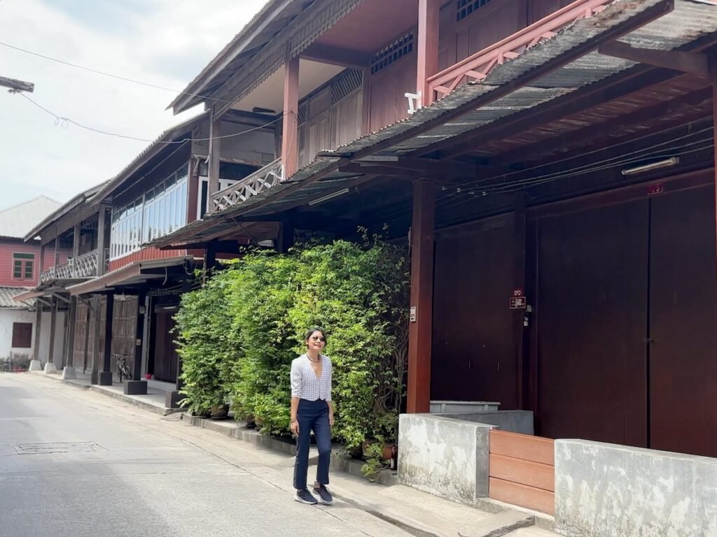
What it offers is something rarer: an authentic working town. The morning market is a market for residents, not tourists. The Chinese-style wooden shophouses in the old town are still occupied by the families who built them. The pace is slower, the prices for everyday goods are lower, and the community is settled.
For an architect’s client choosing between Nathon and the east coast, the question is usually about lifestyle priorities. East coast offers tourism amenity, rental yield, restaurants, and beaches you can swim from. Nathon offers quiet, sunsets, mainland access, lower land cost, and the sense of living in a place rather than a resort. The clients best suited to Nathon are typically those building a primary residence rather than an investment property, and those who value design over location-driven branding.
A practical sequence for evaluating a Nathon plot
If you are considering land in Nathon, the order in which you check things matters. The wrong sequence (looking at a plot, falling in love with the view, then discovering the zoning is wrong) has cost a lot of buyers a lot of money.
Start with the title. Confirm the Chanote (full freehold title) rather than a lesser document. Then check the zoning classification against the current Koh Samui planning map and Ministerial Regulation No. 22, the relevant national instrument. Then check altitude and slope, ideally with a licensed surveyor. Then check distance from the high-tide line if the plot is anywhere near the coast. Only after all four pass should you commission a soil investigation, drainage assessment, and the beginning of a feasibility brief.
Most reputable architects on the island, including this practice, will conduct a preliminary land viability assessment before any design work begins. This is not a sales tool. It is the first stage that determines whether a project is worth pursuing at all, and it can save a buyer from costly surprises after exchange.
Final thoughts
Nathon is not the easiest part of Samui to build on, but it is one of the more honest. The constraints are clear, the infrastructure is real, and the land is priced sensibly relative to what’s permitted. For a residential client who wants a quiet, west-facing home with mainland access and a connection to local Thai life, it is one of the better choices on the island.
For a tourism-oriented investment, it is rarely the right answer. The beach is not a swimming beach, the lifestyle amenities are limited, and the rental market is thin compared to the east coast. But for the right brief, it works, and it works well.
If you are weighing a plot in Nathon, the most useful first step is a site assessment that addresses topography, zoning, altitude, slope, drainage, and infrastructure together, not separately. That assessment is offered as the first stage of every project this practice takes on.
Considering land in Nathon, Bang Por, Maenam, Lipa Noi, Taling Ngam, Bophut, Bangrak, Choeng Mon, Chaweng, or Lamai? Get in touch for a preliminary land viability assessment. Or you can go to our youtube channel and see videos about all of these areas. You can also get really essential advice from our information site www.thetropicalarchitect.com
See also:
Note on regulations: zoning, height, altitude, slope, and environmental protection rules are subject to change and to local enforcement variations. The 21 May 2025 Surat Thani environmental law in particular has introduced new restrictions that may not yet be reflected in older online guides. Always verify current rules with the Land Office and a licensed Samui architect or legal advisor before relying on this guide for any acquisition or build decision.